Warwan Valley Trek Map
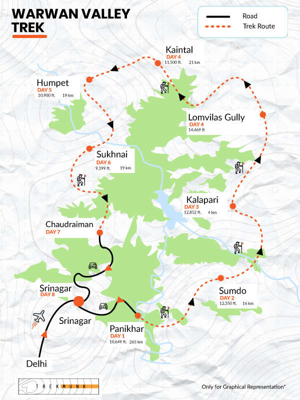
- Warwan Valley Trek Itinerary
Day 1: Srinagar to Panikhar
Altitude: 8,795 to 10,700 ft
Distance: 185 km drive
Duration: 7–8 hours
The journey begins with a full-day drive from Srinagar Airport to Panikhar, covering approximately 185 km.
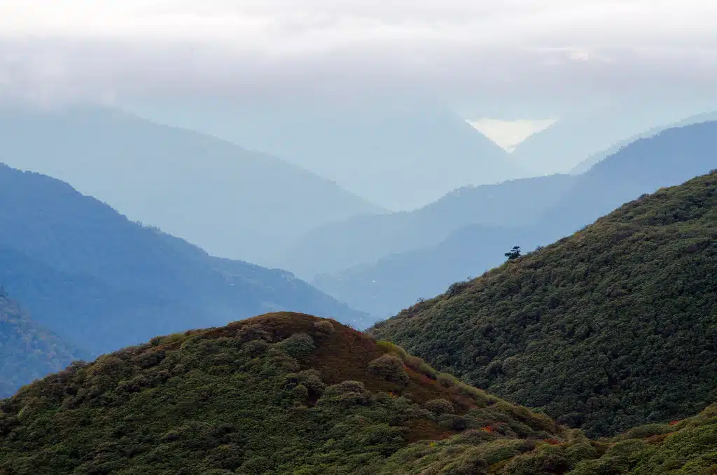
The route passes through Sonamarg, a popular tourist destination in Kashmir. Along the way, the Sindh River flows alongside the road, framed by snow-capped mountains and lush valleys. You’ll pass quaint villages and green paddy fields, offering a perfect introduction to Kashmir’s scenic landscapes.
From Sonamarg, the road ascends to Zojila Pass, a high-altitude pass at 3,528 m connecting Kashmir with Ladakh. The uphill drive rewards you with panoramic views of mountain ranges and valleys before descending into the Ladakh region.
Your route continues through the village of Drass, the second coldest inhabited place in the world. Here, you can stop for lunch and experience the traditional lifestyle of locals, who live largely untouched by modernity.
After lunch, the drive passes through Kargil town and continues to Panikhar, a serene village in Suru Valley. Nestled among mountains, Panikhar is known for its peaceful environment and welcoming locals. Most essential supplies should be purchased beforehand in Srinagar or Kargil, as Panikhar has limited shops. The village sits at an altitude of around 10,800 ft.
Day 2: Panikhar – Acclimatization and Exploration
Altitude: 10,700 ft
Duration: Full day
This day is reserved for rest and acclimatization before the challenging Trans-Himalayan trek begins. Spend time exploring the scenic Panikhar village and its surroundings.
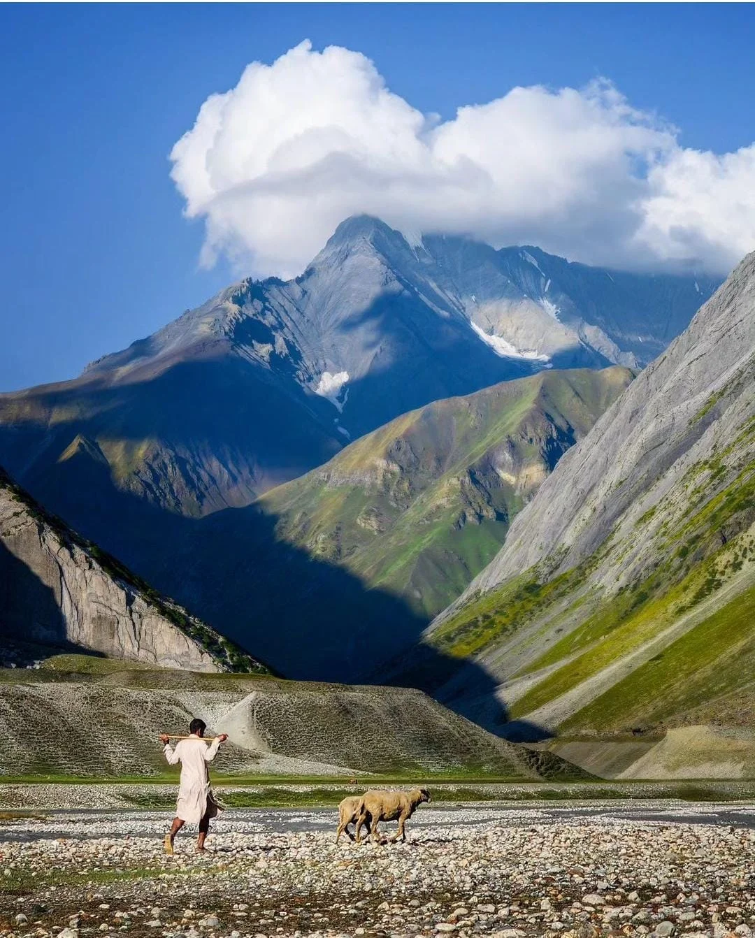
Panikhar lies along the route to Zanskar and the Nun Kun region, making it a peaceful gateway to high-altitude trekking. Take in the serene landscapes, observe locals tending to their farms, and experience the warm hospitality of the village community. Acclimatization here is crucial to prepare your body for the demanding days ahead.
Day 3: Panikhar to Sumdo/Denora
Altitude: 10,700 ft to 12,350 ft
Distance: 14 km
Duration: 5–6 hours
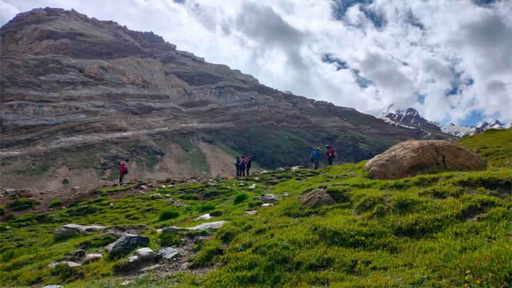
The trek begins alongside the sparkling Panikhar Nallah, following its course before crossing a bridge to the opposite bank. Soon, the village disappears behind you, and the trail opens into a narrow valley with a gentle ascent. The surrounding landscape is stark and barren, while the river flows gracefully along your right.
As you continue, the route reveals more scenic attractions—a wide bridge crossing, lush grassy meadows, and river streams that meander through the landscape. You may spot shepherd settlements along the way, adding a touch of local life to the journey.
Finally, the trail curves to reveal the convergence of two valleys—your destination for the day, Sumdo campsite. Nestled amidst rivers, meadows, and towering mountains, this campsite offers a perfect introduction to the beauty of the Warwan Valley.
Day 4: Sumdo to Kalapari
Altitude: 12,350 ft to 12,875 ft
Distance: 3 km
Duration: 1.5 hours
This day involves crossing several cold river streams, which may take around 30 minutes and leave your feet numb. Panikhar Nallah flows nearby, and the valley hosts another shepherd settlement.
Begin by carefully crossing the streams, following the left-hand valley while staying close to the rushing Nallah. After these crossings, the expansive Denora and Sumdo basin comes into view—a breathtaking panorama of wide meadows adorned with colorful alpine flowers.
Soon, you will reach the serene Kalapari meadow. The campsite is set beside a gentle river stream, offering a peaceful resting spot. This is the shortest and easiest trek day, providing a gentle contrast to the more challenging sections ahead.
Day 5: Kalapari to Kaintal via Lomvilas Pass
Altitude: 12,875 ft to 11,550 ft via 14,550 ft
Distance: 17 km
Duration: 11 hours
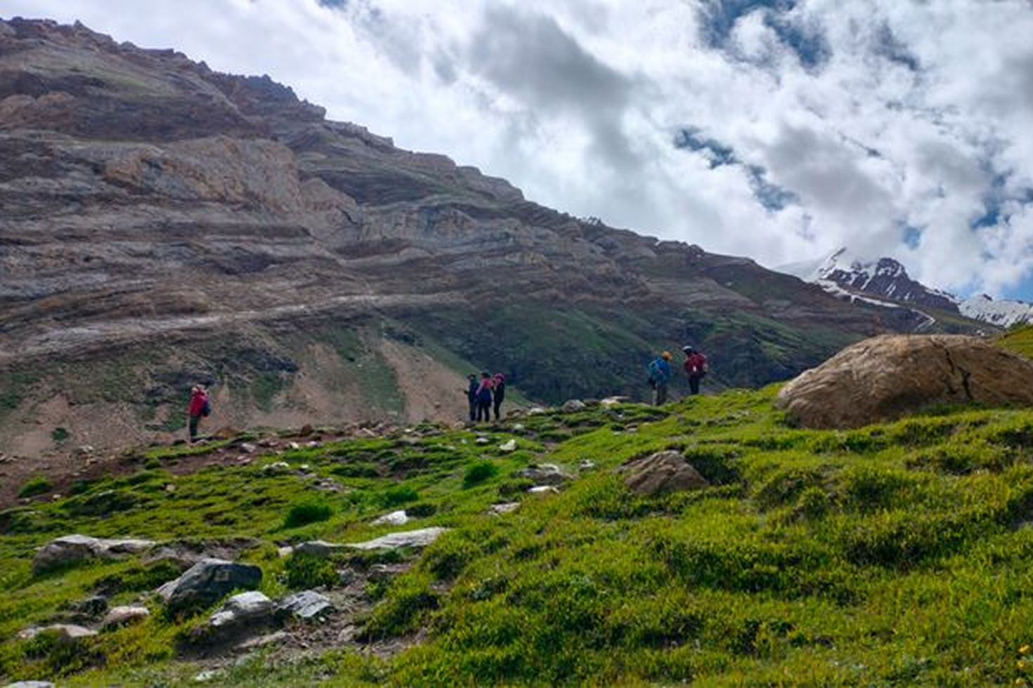
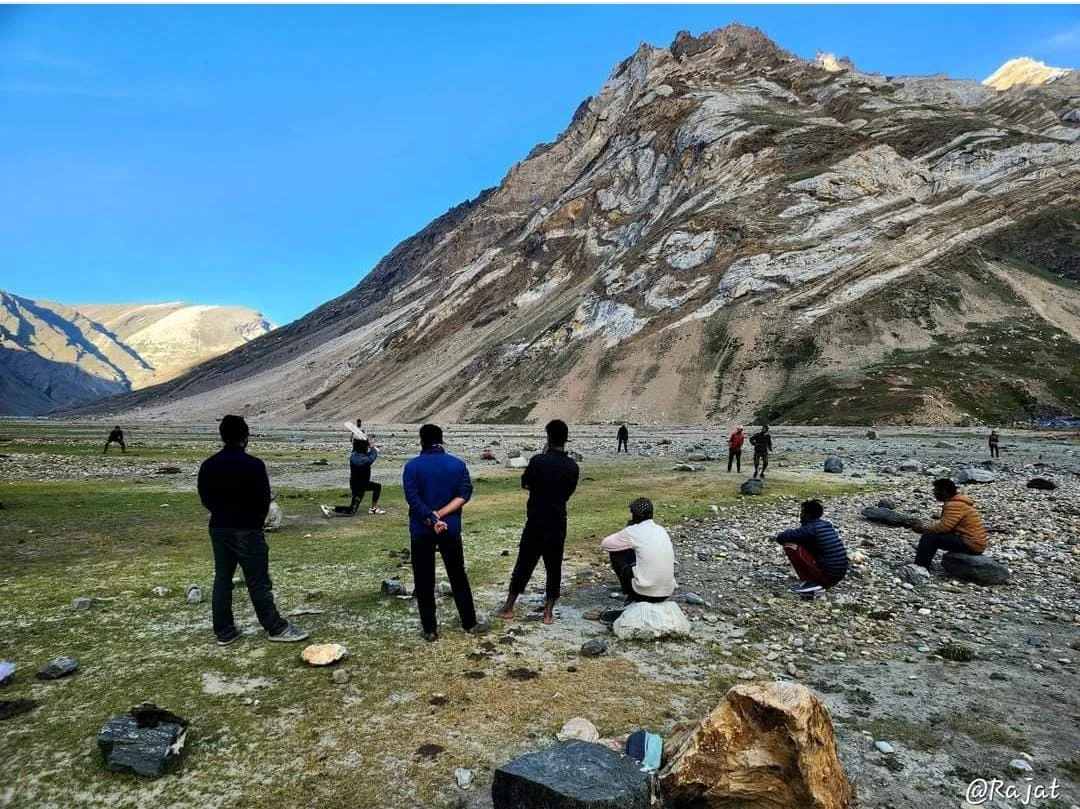
This is the longest and most challenging day of the trek. An early start is essential. After a hearty breakfast, prepare for a tough day covering 17 km with glacier traverses and moraine walks. Trekking poles are sufficient; no special equipment is needed, and the trail is generally safe.
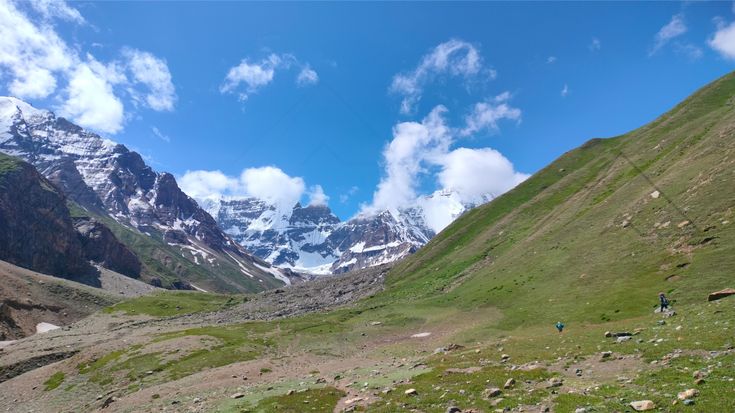
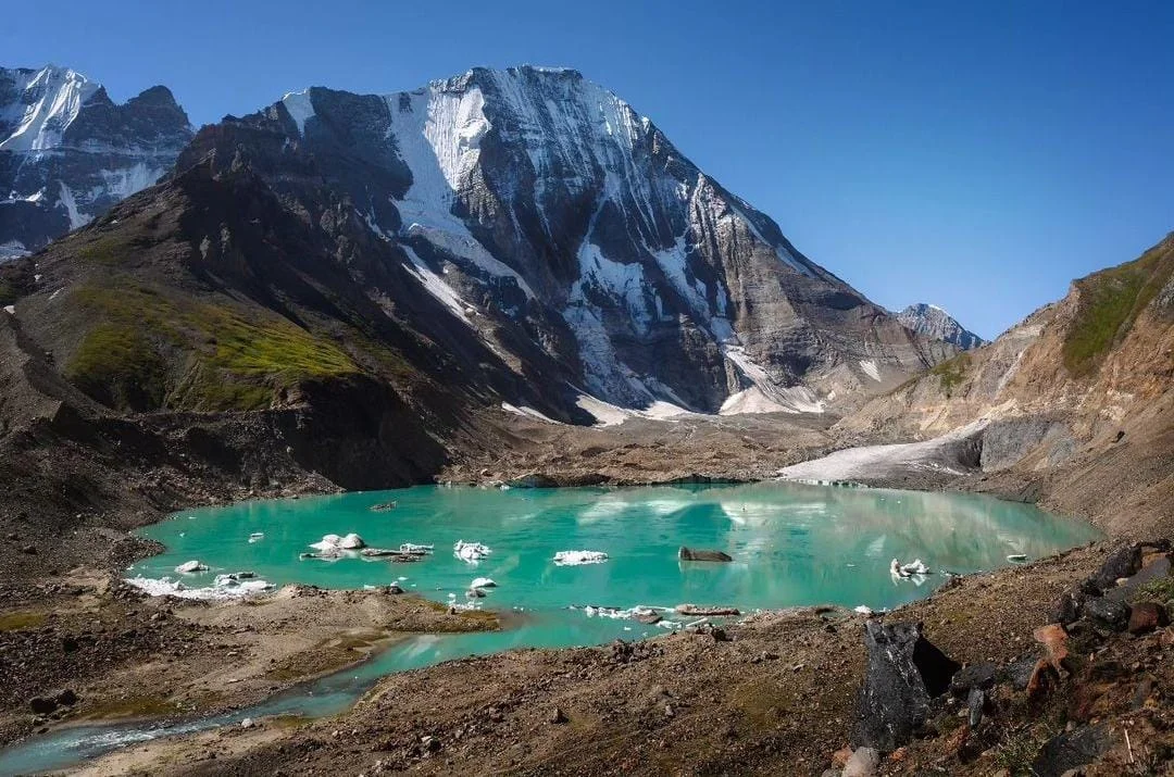
Leaving Kalapari, you first cross moraines and get a panoramic view of the Kalapari summit and glacier. The trail then leads past a stunning glacial lake with chunks of snow floating on its surface. Beside the lake lies the wide Kaintal Glacier, stretching almost a kilometer.
Beyond the glacier, the trail descends into a valley before ascending toward Lomvilas Pass at 14,550 ft. On the way, you will encounter several nearly frozen lakes and gentle snowfields that are easy to walk on.
The descent from the pass involves some icy glacier patches and rocky moraines. Careful steps are needed here. Soon, the Kaintal Valley opens up below, revealing rocky trails that gradually transition into expansive grassy meadows. The campsite sits amid this breathtaking grassland, offering a well-earned rest and one of the most rewarding views of the trek.
Day 6: Kaintal to Humpet
Altitude: 11,550 ft to 10,950 ft
Distance: 16.5 km
Duration: 6 hours
This day involves long stretches of continuous ascents and descents. The trail from Kaintal follows the river, passing through shepherd huts and multiple river streams along the way. Meadows and grasslands stretch for long distances, often with horses grazing peacefully.
The trail leads to several small humps, each offering spectacular panoramic views. Numerous shallow rivers along the path require you to remove your shoes for crossings.
One of the highlights is the Sar Grassland. Beyond this, the Bracken Glacier disappears from view, and the landscape opens up toward Humpet.
Humpet offers a unique contrast: to the west, lush mountains of Kashmir unfold, while to the east, the barren ranges of Ladakh dominate. The campsite is set on a serene grassland with a clear view of the nearby shepherd village, Thangkam, making it a perfect spot to rest after a long day.
Day 7: Humpet to Sukhnai
Altitude: 10,950 ft to 9,225 ft
Distance: 16 km
Duration: 7-8 hours
The trek descends steadily from Humpet into the scenic Sukhnai Valley. Along the way, you will catch glimpses of the route leading to the Amarnath Yatra. Sukhnai, nestled in the Warwan Valley, is home to over 285 plant species, including 26 threatened varieties.
The day begins with a short ascent, followed by a long downhill stretch of about four hours through sprawling grasslands, leading toward Sukhnai Village. A few hours in, you will reach the confluence where a pristine river merges with the Kaintal Nala, forming a wider river. To one side, the trail leads toward the famous Sheeshnag Lake and the Amarnath route.
The trail crosses several overhangs, requiring careful footing and steady confidence. Beyond this, the valley opens up to reveal Sukhnai’s breathtaking grasslands. The final two hours take you through cultivated farms and short fences, giving the trail a serene, European countryside feel. Sukhnai Village welcomes you with its calm charm and natural beauty, marking the end of this challenging yet rewarding trek day.
Day 8: Sukhnai to Basmina to Srinagar
Distance: 15 km
Trek Duration: 5 hours
Drive Duration: 5 hours
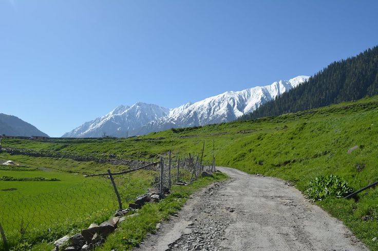
The final day of the trans-Himalayan trek offers a gentle descent through lush grasslands alongside the Marwah River. The trail passes through quaint villages, including Rekenwas, before reaching Basmina. The path is interspersed with small ascents and descents, keeping the walk engaging and scenic.
Rekenwas Village charms with its traditional lifestyle and serene surroundings. Moving forward, Basmina stands out as a slightly larger village with a few local shops and a lively, yet unspoiled atmosphere. The locals are friendly and often curious about your journey, offering a warm welcome. A river runs alongside the village, enhancing the natural beauty of the area.
From Basmina, a cab transfer takes you toward Srinagar. The drive is spectacular, passing through Margan Top and descending into Anantnag district. Scenic villages, orchards, and valleys line the route, eventually merging with NH1, leading you back to Srinagar and marking the conclusion of this remarkable trek.
Highlights of the Trek
Sumdo’s River Delta Basin
Sumdo is a stunning valley where two rivers meet, forming a wide river delta. The flowing waters create small rivulets that weave through the meadows, creating a scenic patchwork of streams and greenery. Trekking through this area, you’ll walk alongside these sparkling rivulets, soaking in the serene landscape.
Bracken Glacier Traverse
The Bracken Glacier marks the most challenging part of the trek. After crossing Lomvilad Pass, you’ll encounter this greyish glacier, which requires careful navigation. It is the longest day of the trek, often taking up to 12 hours, but the views and the experience of walking on this glacier are unforgettable and will remain a highlight of your journey.
Alpine Grasslands
The trek passes through vast alpine grasslands dotted with numerous glacier-fed lakes. These pristine lakes are home to the famous trout and reflect the surrounding mountains in their crystal-clear waters. Walking through these grasslands gives a sense of being immersed in untouched wilderness.
Warwan Village
As you approach Warwan Valley, the landscape transforms into lush greenery. The village here is a picture of traditional life, with charming houses, welcoming locals, and a fresh river running through the middle. Walking through Warwan offers both cultural insights and stunning scenery, making it an ideal spot for photography or simply enjoying the peaceful surroundings.
Inclusions & Exclusions
Inclusions
All vegetarian meals during the trek, including breakfast, lunch, evening snacks, and dinner.
Camp accommodation on all nights in high-quality twin-sharing tents. Includes sleeping bags, sleeping mattresses, dining tents, and cutlery.
Assistance from camp helpers for pitching tents, washing dishes, serving food, and general support at the campsite.
Trek leaders and guides with mountaineering qualifications and experience, along with skilled cooks.
All essential mountain medicine, including first aid and oxygen cylinders.
Necessary passes and permits for the trek.
Exclusions
Lunch on the first day of the trek.
Personal expenses.
Anything not specifically mentioned in the inclusions list.
Offloading and transportation costs outside the trek itinerary.
Tips to Plan Your Trek
How to Reach Base Camp
By Air:
The nearest airport is Srinagar Airport, which is the quickest way to reach the region. Book your flights in advance, especially during peak season. From the airport, take a cab or taxi to Srinagar city. From there, it’s a road journey of approximately 265 km to Panikhar via Sonamarg and Kargil, taking around 10 hours. It is advisable to keep a buffer day before the trek for rest and acclimatization.
By Train:
Jammu Tawi is the closest railway station. From Jammu, travel about 210 km to Srinagar by bus or cab, and then continue the same route to Panikhar. Allow at least 2 buffer days if traveling by train to account for transfers and road conditions.
By Road:
Panikhar Valley in Zanskar is remote and offbeat, with limited local knowledge and no mobile network en route. The drive from Srinagar via Sonamarg and Kargil takes a full day. Similarly, returning from Warwan at the end of the trek involves a long journey over Margan Top. Roads are scenic but require experienced drivers for a smooth journey.
Trek Transportation:
To ensure a safe and hassle-free journey, transportation is provided as part of the trek. Pick-up and drop-off is available from Srinagar. Our drivers are familiar with the route and campsite locations. You can also book local cabs via the Kashmir Taxi Service option for added convenience.
Things to Carry on Warwan Valley Trek
Backpack: A 60-litre backpack is recommended to carry all your essentials comfortably.
Trekking Shoes: Sturdy, high-ankle trekking shoes are essential for stability on uneven terrain.
Clothing:
T-shirts: One full-sleeve dry-fit T-shirt and at least two additional T-shirts.
Insulation Layers: Three layers are advised – two light fleece jackets and one full-sleeve sweater.
Outer Layer: One padded or down jacket for warmth.
Trek Pants: Two pairs are sufficient for the entire trek.
Trekking Poles: Two trekking poles provide better balance and support than one.
Rain Gear: A poncho is preferable to a rain jacket as it covers both you and your backpack.
Backpack Rain Cover: Protects your gear from rain and prevents wear and tear.
Daypack: A small bag of 20–30 litres to carry essentials like water, snacks, headlamp, and rainwear.
Sunglasses: Protect your eyes from glare and harmful UV rays.
Synthetic Gloves: Useful during early mornings and evenings for warmth.
Fitness Tips & Importance for Warwan Valley Trek
Being physically prepared is crucial for completing the Warwan Valley Trek safely and enjoyably. Lack of fitness can lead to injuries, extreme fatigue, or high-altitude sickness, potentially cutting your trek short.
Pre-Trek Preparation:
Begin jogging or brisk walking 2–3 months before the trek to strengthen the muscles used during trekking.
Include strength training 3–4 times a week, focusing on legs, core, and upper body.
Maintain a well-balanced diet rich in protein and nutrients to support endurance and recovery.
During the Trek:
Stay hydrated by drinking plenty of water regularly.
Take acclimatisation seriously. Spend time adjusting to high altitudes to avoid altitude sickness.
Proper fitness and acclimatisation ensure you enjoy the breathtaking landscapes of Warwan Valley without compromise.
Photography Spots on Warwan Valley Trek
Local Villages:
The villages in Warwan Valley offer a glimpse into authentic Kashmiri life. Capture the charming homes framed by hills, but always ask for permission before photographing the locals. They are welcoming and often greet visitors with a warm smile.
Streams and Rivers:
The Warwan River and its tributaries flow through the valley, creating stunning basins and natural scenery. Numerous small streams and waterfalls along the trail provide perfect spots for photography, complemented by the surrounding flora.
Meadows and Grasslands:
Kalapari and Kaintal meadows are breathtakingly beautiful and resemble cinematic landscapes. These lush grasslands offer endless opportunities for scenic and aesthetic photos, making memories that last a lifetime.

Facts About Warwan Valley Trek
Lost World:
Warwan Valley is often called a ‘lost world’ due to its remote location in Kashmir. The valley is largely disconnected from the outside world, offering trekkers a chance to explore landscapes and sites that feel untouched and rarely seen.
Traditional Lifestyle:
The local villagers have preserved their traditions and culture over generations, largely untouched by modernity. Horses remain the primary mode of transport on the uneven roads, giving visitors a glimpse into a mountain lifestyle vastly different from city life. This cultural immersion adds depth and meaning to your trek.
Circular Villages:
The villages here are uniquely circular in layout. Temples often occupy the center, surrounded by homes, with fields encircling the settlements. These fields form the primary livelihood for the locals and reflect their close connection to the land.
Margi Tragedy:
In October 2016, Margi Village suffered a devastating fire that destroyed the entire settlement. The residents are still waiting for recovery and hope, making the story of Margi a poignant part of the valley’s history.
Is Warwan Valley Trek Safe?
The Warwan Valley Trek is safe when approached with caution and proper guidance. Following your trek leader’s instructions is essential, as they are well-versed in the terrain, risks, and safe navigation techniques.
This trek is best suited for trekkers with prior high-altitude experience, as it is moderately challenging. Proper acclimatisation before and during the trek is crucial to prevent altitude-related issues. Maintaining good cardiovascular fitness and overall endurance will help you stay healthy and enjoy the journey safely.
With preparation and caution, the Warwan Valley Trek can be a secure and unforgettable adventure.